 |
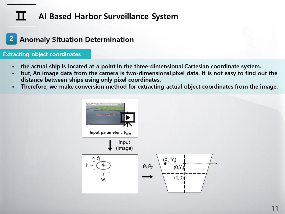
An image data from the camera is two-dimensional pixel data. It is not easy to find out the distance between ships using only pixel coordinates. However, the actual ship is located at a point in the three-dimensional Cartesian coordinate system. If the three-dimensional position of the ship can be determined by transforming the pixel coordinates, the distance between the ships can be calculated. For obtaining 3D coordinates using a single camera, we make two assumptions that all objects are at sea(or ground) level and that the angle of one pixel is the same. The conversion process is schematically illustrated as in figure.
|
 IEEE/ICACT20230138 Slide.10
[Big Slide]
[YouTube]
IEEE/ICACT20230138 Slide.10
[Big Slide]
[YouTube]